
Trace a Weld County Street by Address
A Weld County street directory search works best as a chain of address keys. Begin with the Assessor's Property Data Search, retain every account returned, and compare the situs address with the owner's mailing address. Then use the GIS map to check the parcel and the recorded-document index to follow parties through time. Voter information, code cases, and historical directories add distinct clues, but none is a complete list of every person connected to a street.
Keep a dated worksheet. Record the exact query, account, parcel, legal description, source URL, and what the result actually says. The same street can have repeated names, split parcels, rural road aliases, or a mailing city that does not match the municipality. These five moves keep a by-address search anchored:
- Enter a full or partial address in the Weld County Assessor Property Data Search, then save each candidate account.
- Compare situs and mailing addresses and copy the parcel, subdivision, block, lot, and legal description.
- Open the Weld GIS map, select the parcel, and click nearby polygons only after the known account is confirmed.
- Search the recorder as grantee, locate the purchase instrument, then use its grantor and reception number to find an earlier link.
- Use the Colorado voter route and local historical directories as separate evidence, not as a substitute for the parcel record.
Note: A listed owner, registered voter, or historical occupant answers a different question than a complete current household list.
Weld County Assessor Searches for Street Records
The Assessor portal has one required Search field with a maximum length of 50 characters. It accepts a name, full or partial address, account, subdivision, parcel, legal description, or section-township-range. Subdivision searches can be paired with block and lot, while a rural search can use the land description when a street label is new or missing. The site also offers Help and Map Search controls and does not require a payment or login.
Its result card can include account and parcel numbers, situs and mailing addresses, listed owners, property class, tax year, values, legal lot, block, subdivision, section, township, range, land area, buildings, construction, year built, and sale or document history. The mailing line is where tax correspondence goes. It can help locate the next record, but it does not prove physical presence at the parcel.
| Field or control | Type | Street-search use | Retain |
|---|---|---|---|
| Search | Required text, maximum 50 | Address, name, account, subdivision, parcel, legal description, or section-township-range. | Exact query and result accounts |
| Address | Text within Search | Full or partial situs string; test directional prefixes and abbreviations. | Situs, account, parcel |
| Owner | Text within Search | Name search for listed owner, then verify map geography. | Owner and mailing fields |
| Subdivision, block, lot | Text within Search | Bridge key when a street number changed or repeats. | Legal lot, block, subdivision |
| Section, township, range | Text within Search | Rural or unnamed-road research. | Land-description components |
| Map Search | Link or button | Browse parcels and compare adjoining polygons. | Map date and selected account |
The exact field set makes Weld's property roll a strong first step in a street directory, even when the final question concerns an older occupant or a different custodian.
Weld GIS Parcels Along a Street
The Weld County GIS Property Map is the spatial handoff from a street string to a parcel account. Search or pan to the road, select the known polygon, and copy the account and legal description back into the Assessor report. For a street-by-street sweep, move to the next adjoining polygon only after the first selection has been checked against its address and map position.
The county GIS program provides map, data, download, interactive, and PDF-map resources. The no-script research capture did not expose a stable list of current layer names, so the safe instruction is to use the visible parcel and selection functions and verify any district, zoning, flood, road, or other layer on the live map. Do not turn an unconfirmed layer into a claim about a person.
Adjacent parcels also require restraint. A parcel map can reveal a legal unit and a listed owner. It does not reveal every household member, visitor, delivery recipient, or person who uses the property. When the goal shifts from a whole street to one person, the Weld County resident lookup workflow uses different checks.
Weld County Street Directory Records
Address-keyed sources overlap, but their fields do not mean the same thing. The property roll is parcel-centered. The recorder is instrument-centered. The voter file is registration-centered. A code case is event-centered, and a reverse directory is a historical occupant clue. A street directory becomes more accurate when the account or legal description is carried from one source to the next.
| Record set | Keeper | What it shows | Access |
|---|---|---|---|
| Property report | Weld Assessor | Listed owners, mailing/situs fields, parcel and building context | Free portal |
| GIS parcel map | Weld GIS | Parcel location, boundaries, adjacent accounts, visible public layers | Free viewer |
| Deed and instrument index | Clerk and Recorder | Grantor, grantee, reception, date, type, legal-description trail | Free index, paid copies |
| Voter file | Colorado Secretary of State | Defined public voter fields and participation history | Individual tool or request |
| Code Compliance table | City of Greeley | Selected nuisance case, address, named party, and date | Current public rows |
| Reverse directory | Library or local collection | Historical address-to-occupant clue | Repository access; years vary |
The street name ties the sources together for a human reader, but the account, reception number, legal description, case number, or page is the stronger machine-readable bridge. Preserve that key even when an image or request must be handled later.
Weld County Legal Description Keys
Parcel language can feel dense until each term has a job. Subdivision, block, and lot identify a platted part of a development. Section, township, and range describe rural land. A plat is the recorded map that creates or explains lots and roads. A situs address says where the parcel is located, while a mailing address says where tax mail is sent.
- Parcel or API
- The Assessor's stable parcel identifier. It is useful when a road name or house number changes.
- Situs address
- The physical location assigned to the parcel, which may differ from a mailing address.
- Plat
- A recorded map showing lots, blocks, easements, and streets for a subdivision or land division.
- Criss-cross directory
- A directory organized by address, often used to connect a historical street line to an occupant.
The bridge matters in Weld County because a rural road segment can carry several historic numbers. A modern street query that produces no match should be repeated with the parcel, legal description, subdivision, and county-road history.
Weld County Deed Chains by Street
Once the Assessor identifies a parcel, the recorder can turn one current owner line into a historical chain. Search the current owner as grantee. Open the purchase instrument or record its reception number and date. The grantor becomes the next name to search. Repeat with the prior grantee, legal description, subdivision, block, and lot when a party name is common. “Find Related” can follow a referenced instrument or shared legal description.
Weld's recorder index reaches back to 1865. It supports grantor, grantee, combined party, reception number, date, document type, subdivision, block, lot, and legal-description fields. Basic search uses last-name-first order. Advanced search supports wildcards, required terms, and exclusions. The index is free, while images, copies, and certification use the county fee schedule. Read the original instrument before relying on an instrument code or legal wording.
Weld's recorder search-help page explains word order, wildcards, related documents, and the warning against unattended or automated searching.
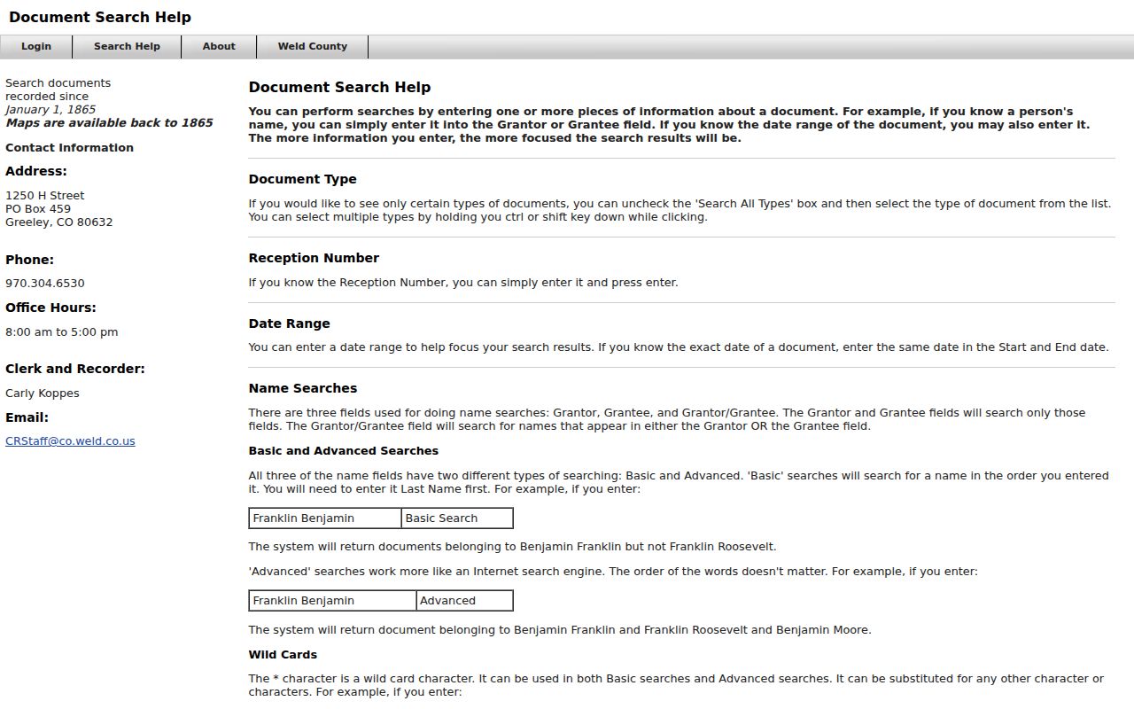
The search-help image is useful when a street name fails but a legal description, reception number, or party variant can succeed.
Greeley Address Cases and Colorado Voter Records
Greeley Code Compliance is one of the few confirmed city sources with selected address-keyed name rows. Its chronic public-nuisance table can show a case number, address, owner or named party, and date. The research capture included PN2310-0001 at 715 20th Street and PN2603-0001 at 2495 28th Street. Those rows are enforcement leads, not a complete city history or proof of a current condition.
The Colorado voter web tool cannot enumerate a street. It requires first name, last name, ZIP, birthday, and CAPTCHA. The broader voter-file request can include defined public fields, but protected voters and confidential addresses remain outside the release. Building, utility, DMV, and customer records are not substitutes for a street directory. Ask the relevant custodian through a narrow CORA request when an address-keyed series is not online.
Greeley Code Compliance's public case table demonstrates the difference between a selected address record and a complete list.
The code-compliance image should be read with its date and case context. An address row is one public event, not a conclusion about every person associated with the parcel.
Historical Weld County Street Directory Clues
For an older occupant, ask High Plains Library or Hazel E. Johnson for reverse and criss-cross volumes, beginning with the confirmed 1892 and 1903 Greeley directory leads. Read the address section, preserve the page and abbreviation key, then find the same name in the alphabetical section. Pair the result with the Weld County Master Index, a Greeley Tribune notice, a census year, or a Sanborn sheet.
The directory and parcel may describe different relationships to the same place. A historical directory can identify an occupant, spouse notation, occupation, or business line. The Assessor can identify a later listed owner. A newspaper can explain a move, marriage, death, or address change. These clues belong together only after their dates and source meanings are written down.
Note: A directory gap may reflect publication choices, delayed updates, or a missing volume rather than a confirmed move away.
Weld County Road Numbers and Old Addresses
Weld's rural addressing has a specific continuity trap. The official right-of-way guide says a county road segment can carry several historic numbers and that WCR49 has different historic identifiers along different segments. Petitions, grants, segment records, and the 1937 road book can bridge a modern delivery label to an older land or deed reference. Preserve the road name, historic number, section-township-range, subdivision, and parcel together.
Greeley address research needs a similar bridge. Align a directory year, Sanborn sheet, legal description, historic-tour landmark, and modern parcel map before deciding that an old address is absent. The downtown historic tour centers early activity around 8th Street between 8th and 9th Avenues, while the courthouse at 915 10th Street supplies a durable reference point. A map and a page number can be more reliable than a street string alone.
The 1937 road book is an interest-layer shortcut because it explains why a rural Weld County street directory can miss a known place. It turns an apparent blank into a road-history question.
Limits of a Weld County Street Directory
A Weld County street directory can show listed parcels, owners, recorded parties, selected public cases, registered voter fields released by law, or historical occupants. It cannot show every person in a building or household. Utility customer records are not a public people list. DMV information is restricted by the federal Driver's Privacy Protection Act and Colorado law. Protected voters and Address Confidentiality Program participants may be absent by design.
Use the least amount of personal information needed for a lawful purpose. Do not copy a full birthday, signature, identification number, substitute address, or unverified same-name result. If an image is unavailable, request the instrument from the Clerk and Recorder. If a permit or code series is missing, name the agency and date range in a CORA request.
Lawful personal use. Weld County address records support personal research, family history, house history, and civic curiosity. Using a street directory to stalk, harass, threaten, or intimidate another person can create criminal and civil exposure under Colorado law.